Lot 410: Sold for £140 hammer
An Antiques & Collectables Sale to include Militaria, Maps & Garden Furntiure,
Thursday 12th May 2016
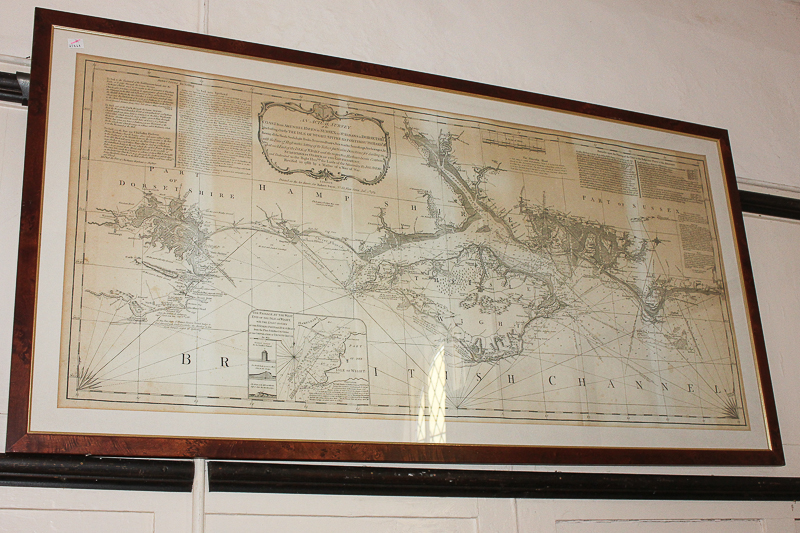
Robert Sayer, an 18th century map of the Isle of Wight and parts of Sussex, Hampshire and Dorset coastline, with text on sailing directions and cartouche and inscription dated 1789, framed, 55cm by 119cm
Valuation days
Mon 6th July - Book an appointment 01243 532 223
Valuation Day for Jewellery & Watches