Lot 398: Sold for £260 hammer
An Antiques & Collectables Sale to include Militaria, Maps & Garden Furntiure,
Thursday 12th May 2016
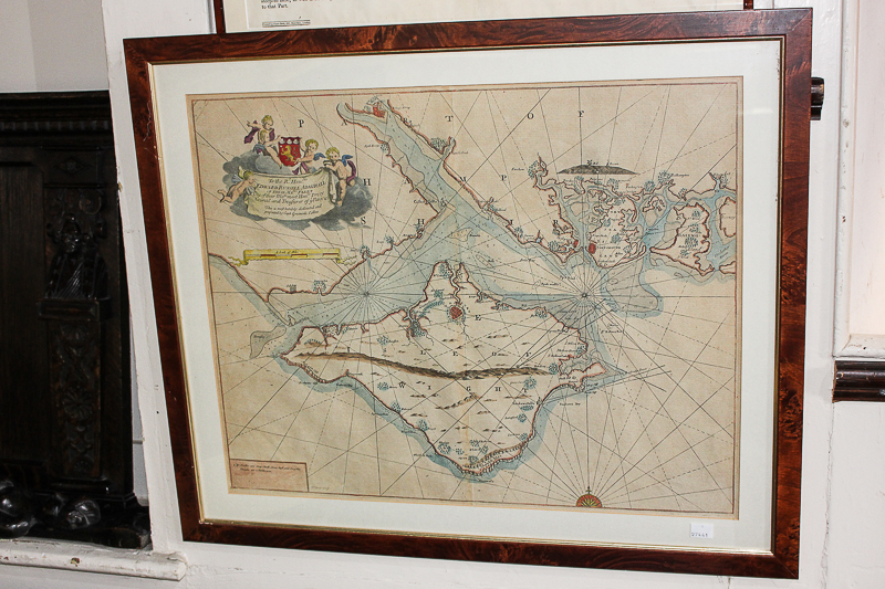
J Harris, an 18th century map of the Solent with the Isle of Wight and surrounding areas, with dedication to the Rt Hon Edward Russell, Admiral of the Fleet, presented by Capt Greenvile Collins, framed, 46cm by 58cm
Valuation days
Mon 6th July - Book an appointment 01243 532 223
Valuation Day for Jewellery & Watches