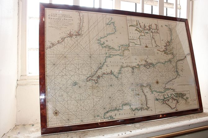
Mount and Page, an 18th century chart map showing the English Channel with the coastline of England and France, with inscription and additional plans of Plymouth Sound and the Isle of Wight, observed by Dr Halley, published by Page and Mount on Tower Hill, London, framed, 65cm by 101cm
Valuation days

Related lots from this sale

Lot 366: Sold for £140 hammer

Gertrude Hermes RA (1901-1983), fish on a line 'Remote Control', lino cut print,...

Lot 385: Sold for £140 hammer

Late 19th century Continental school, pair of still lifes with flowers in vases,...

Lot 387: Sold for £260 hammer

Monica Poole (1921-2003), dandelion, woodblock print, signed in pencil, numbered...

Lot 415: Sold for £170 hammer

Emmanuel Bowen, an 18th century chart map, the Isle of Wight and the coastline o...

Lot 416: Sold for £130 hammer

An early 19th century French chart map of Portsmouth and Langstone Harbours, 98c...

Lot 357: Sold for £90 hammer

Five Thomas Moule county maps, 19th century, to include Sussex, Hampshire, Isle ...

Lot 370: Sold for £95 hammer

Nigel Purchase (b.1940), historical family group portrait with artist viewed thr...

Lot 378: Sold for £165 hammer

George Furst, sailing ships in a bay, oil on canvas, signed, 52cm by 70cm...

View all Paintings & Maps from this sale