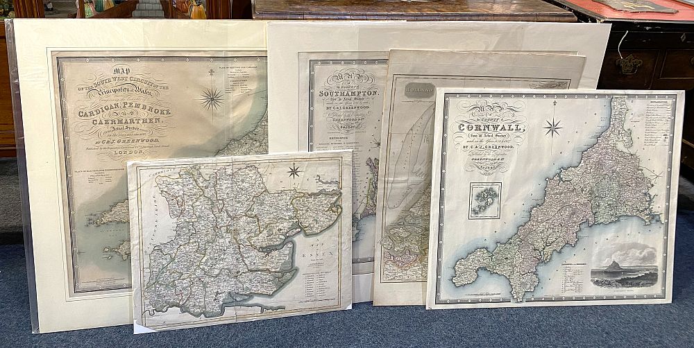
Five unframed 19th century maps comprising a 'Map of Essex from the beft [sic]' engraved by J Cary, pub 1805, 45cm by 58cm, a 'Map of the County of Southampton from an Actual Survey made in the Years 1825 & 1826 by C & J Greenwood & Co.', pub 1829, 63cm by 76cm, a 'Map of the South West Circuits of the Principality of Wales [...] by C & J Greenwood & Co., pub 1834, 63cm by 79cm, a Map of Cornwall by C & J Greenwood & Co., pub 1829, 62.5cm by 73.5cm, and a map of 'Holland drawn & engraved for Thomson's New General Atlas 16th Sept 1814', 73cm by 55cm

Valuation days

Related sold lots

Lot 211: Sold for £100 hammer

A framed Jan Jansson 'Anglia Regnum' map, hand coloured, probably 17th century, ...

Lot 75: Sold for £420 hammer

Flight Lieutenant DM Crook DFC, Spitfire Pilot a signed copy by the author, publ...

Lot 685: Sold for £25 hammer

A 17th century edition of Camden's Britannia with English text, translated from ...

Lot 81: Sold for £20 hammer

A collection of shipping charts to include St Vincent and Northern Part of The G...

Lot 77: Sold for £190 hammer

A miniature almanack, Goldsmith. An Almanack for the Year of our Lord God, M.DCC...

Lot 125: Sold for £70 hammer

A framed 17th century John Seller map of the British Isles 'Insulae Albion et Hi...

Lot 287: Sold for £100 hammer

John Ogiby, four 18th century engraved road maps to London to Arundel, London to...

Lot 629: Sold for £12 hammer

A collection of 20th century maps of Hampshire, Devonshire, Gloucestershire etc,...

View more sold Books & Maps