Lot 242: Sold for £100 hammer
An Antiques & Collectables Auction,
Thursday 20th February 2025
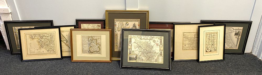
Yorkshire & English County Maps: A collection of eleven maps, 18th and 19th century including: two maps 'Yorkshire West Riding' and 'Yorkshire: Parts of the East & West Riding', engraved by Cole published by Vernor, Hood & Sharpe, Poultry, to accompany the beauties of England and Wales, dated 1st October 1808; a handcoloured map of the North Riding Yorkshire, labelled Moule 1836; a handcoloured map of the West Riding Yorkshire, labelled Moule 1846; Thomas Moule (1785 - 1854) Yorkshire East Riding ; York to Tadcaster road map, published for Bowles & Carver, London; 'A Map of the West Riding of Yorkshire'; Sussex map drawn and engraved by J. Archer, Pentonville, London; a handcoloured road map from Manchester to London (Post Office); WIlliam Henry Toms (18th century) and Beasdale 'Lancashire' market towns map, published Sept 29 1742; 'Lancashire' hand coloured map, with image of Nelson's Monument Liverpool, all framed (11)