Lot 76: Sold for £45 hammer
An Antiques & Collectables Auction to include Travel, Scientific Instruments & Clocks,
Thursday 16th November 2023
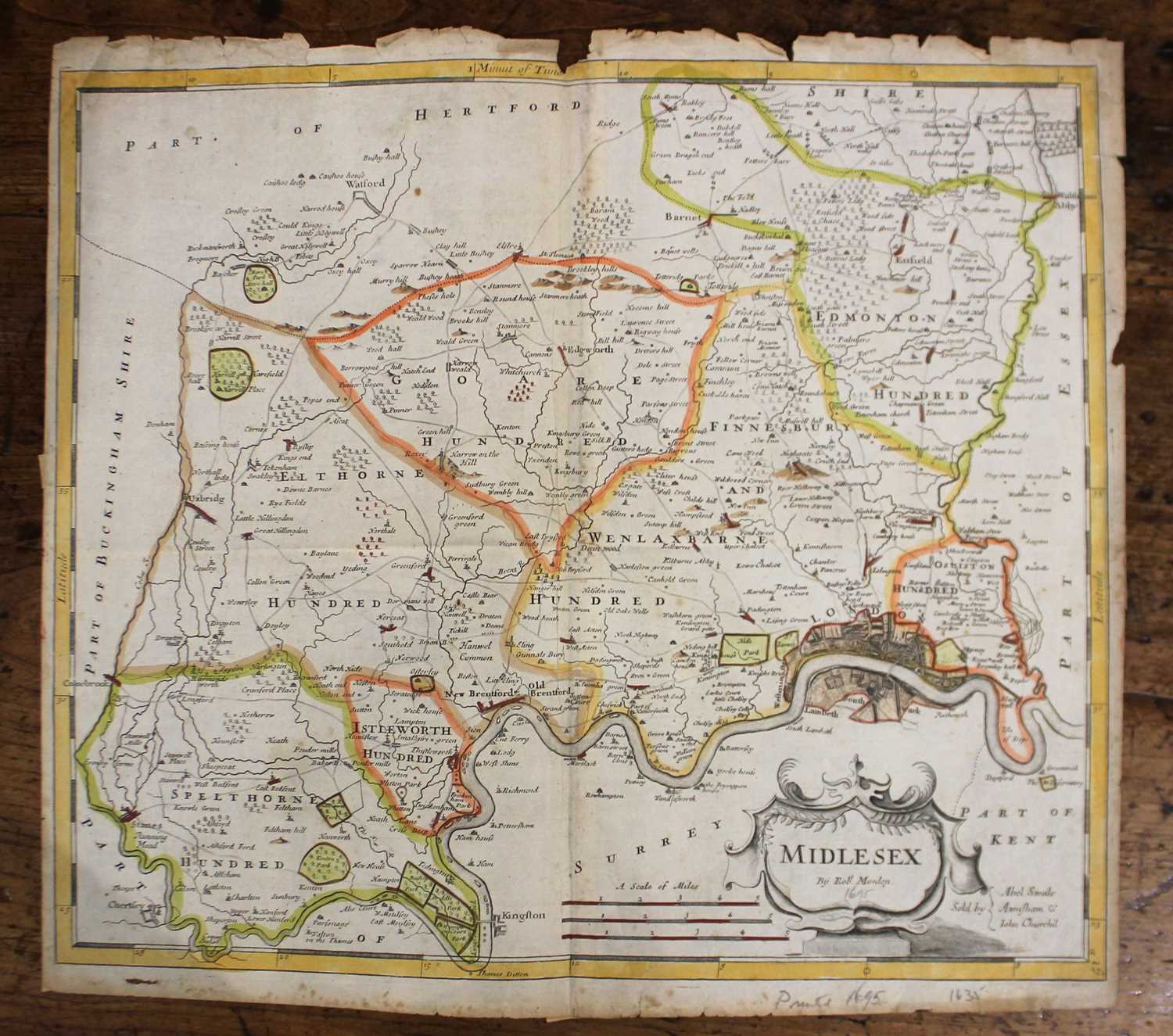
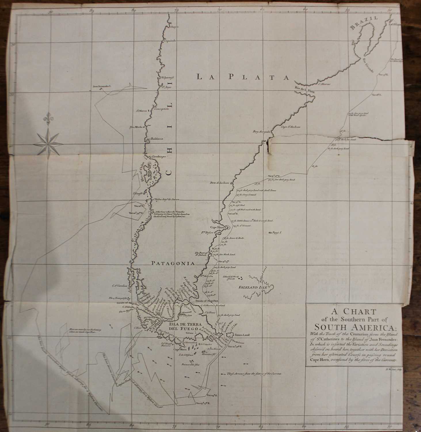
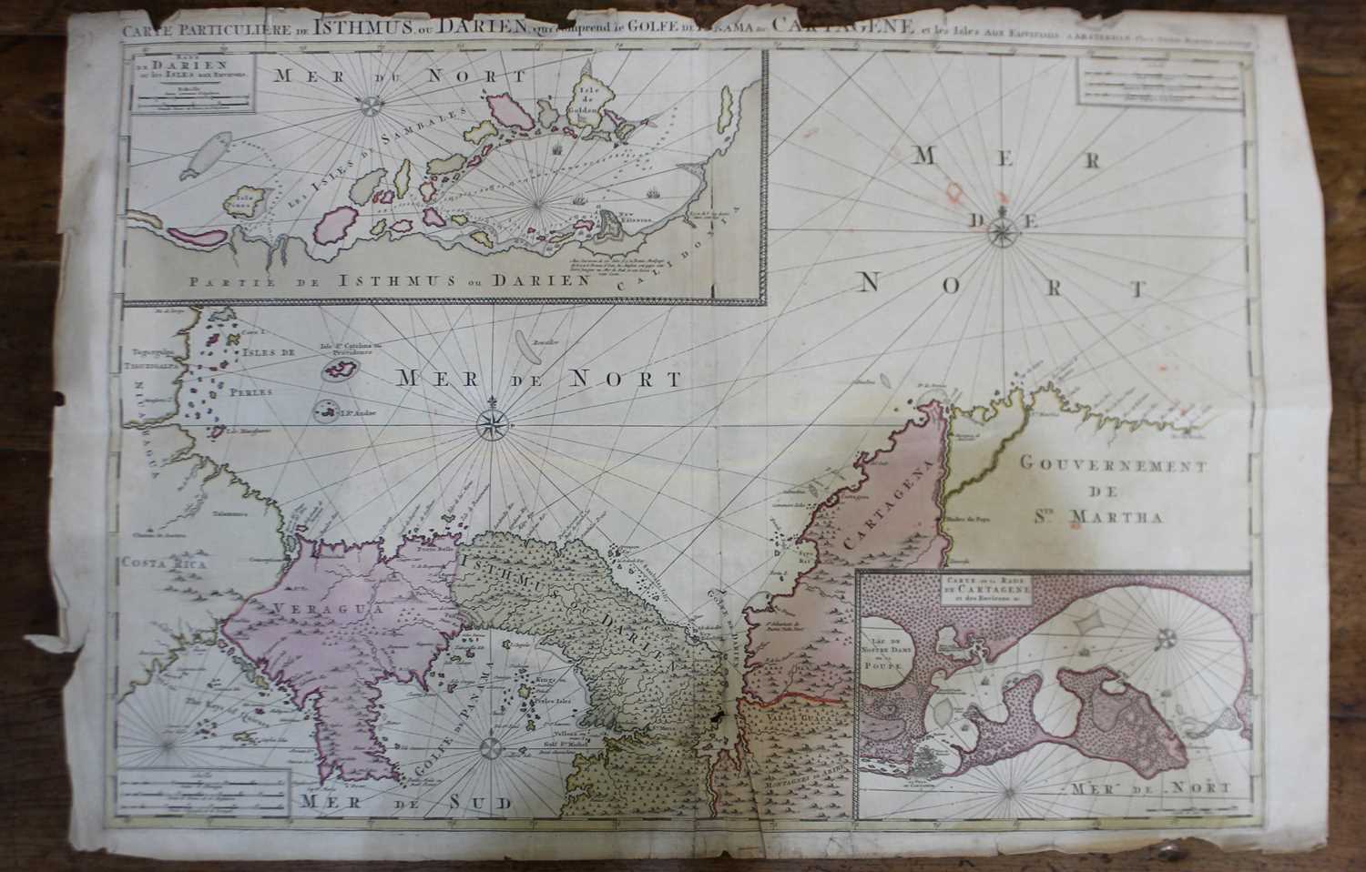
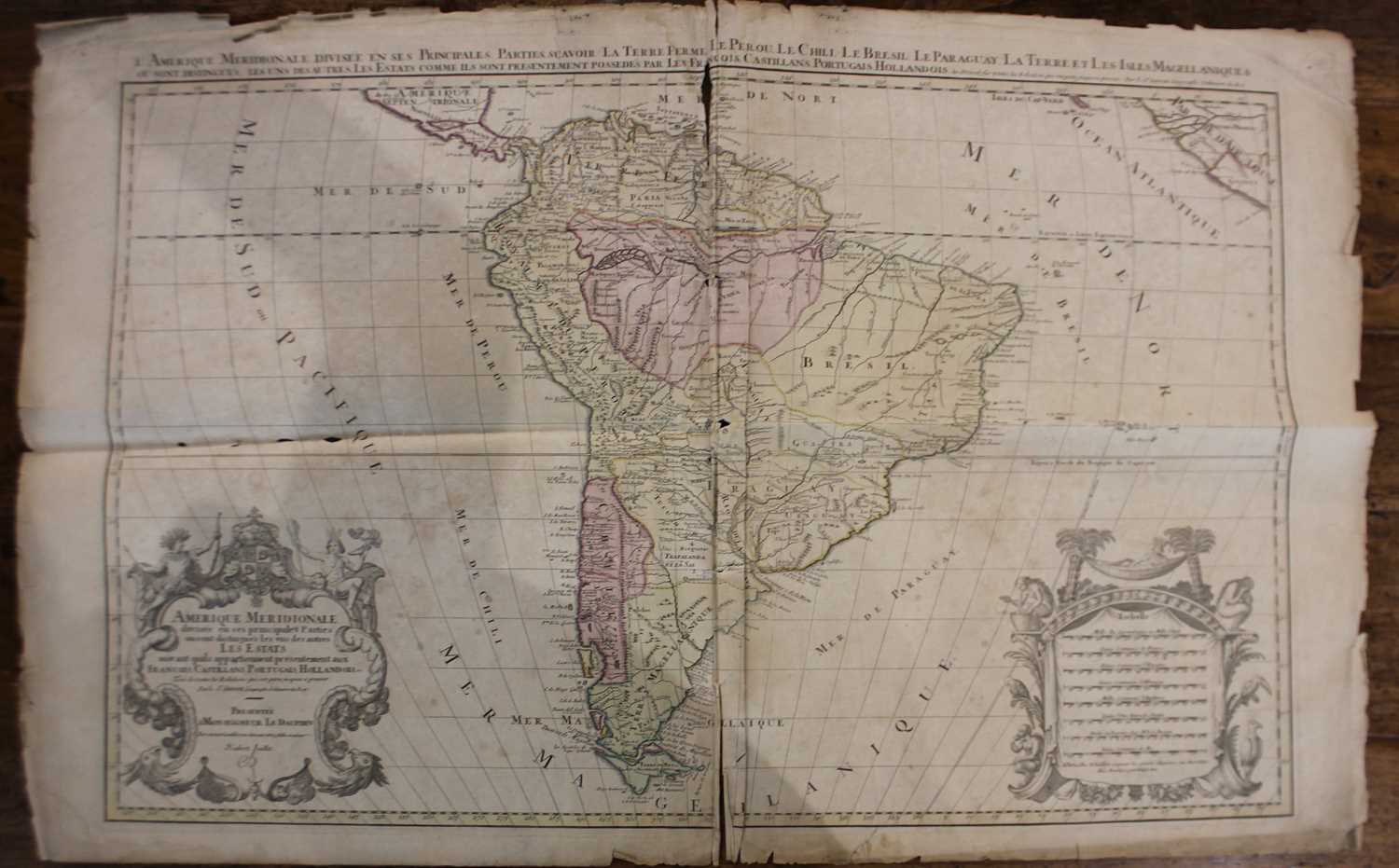
Three charts and maps of South America and the Caribbean sea, comprising Mortier, Pierre, Carte Particuliere de Isthmus, ou Darien, qui comprend le GOLFE DE PA NAMA etc, CARTAGENE, et les Isles Aux Environs, 62cm by 93cm, Jaillot, Alexis-Hubert, Amerique Meridionale Divisee en ses Principales Parties ou sont Distingues les uns des Autres les Estats Suivant Quils Appartiennent Presentement aux Francois, Castillans, Portugais, Hollandois, &c...,63cm by 101cm, and Seale, Richard, A chart of the southern part of South America, with the track of the Centurion [...]., 51cm by 48cm, together with a Robert Morden map of Middlesex 'Midlesex', 38.5cm by 43cm (all a/f)
Valuation days
Mon 10th August - Book an appointment with our specialist 01243 532 223
Valuation Day for Silver, Jewellery & Watches