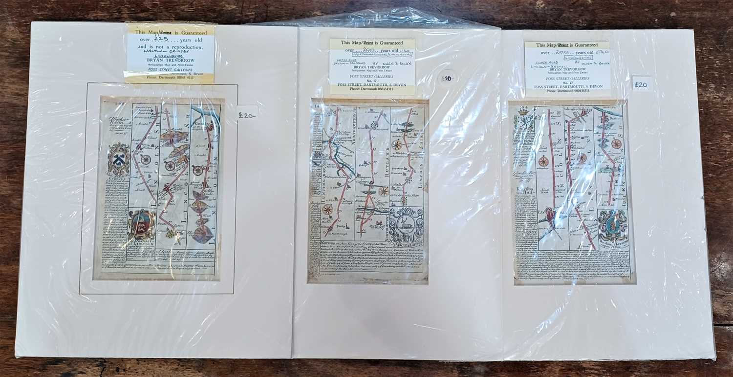
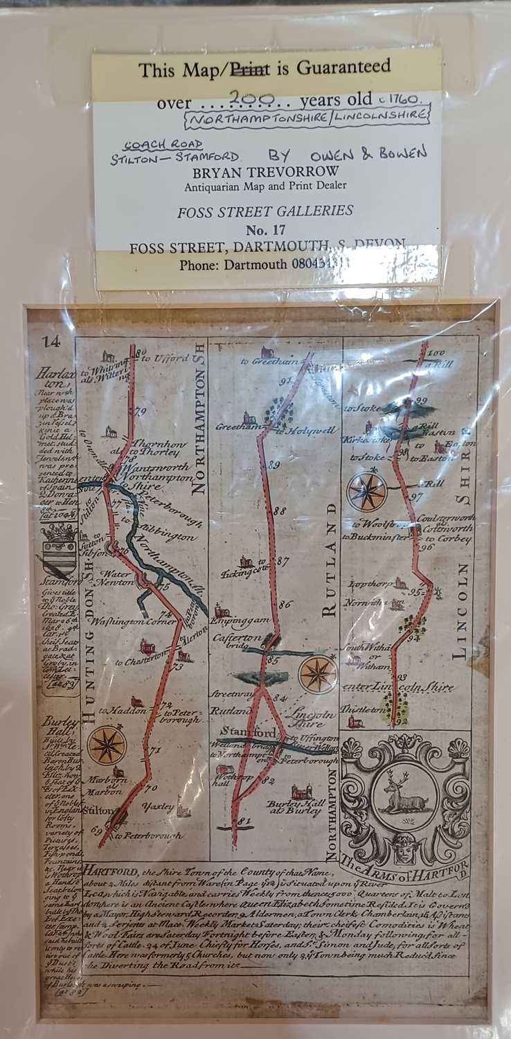
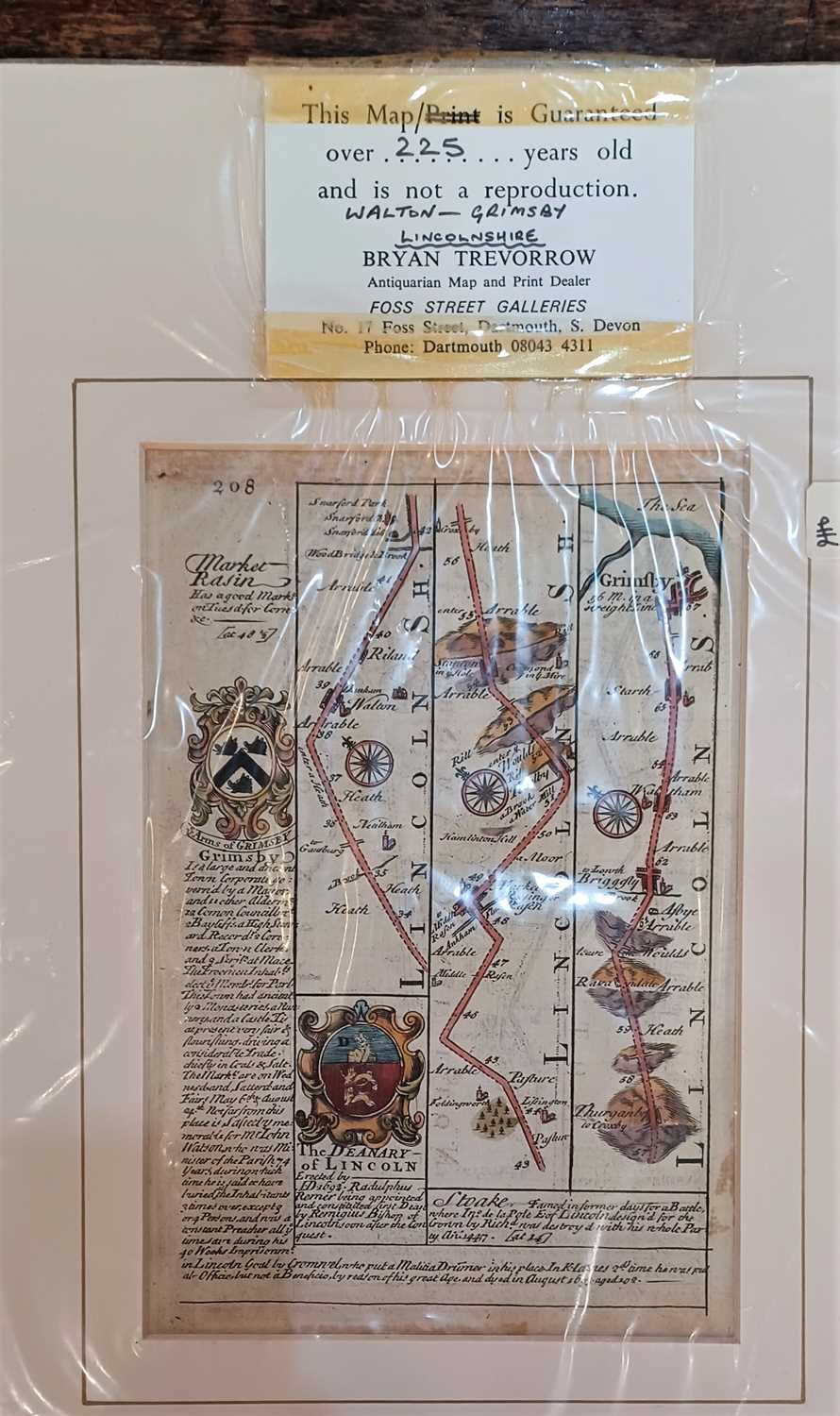
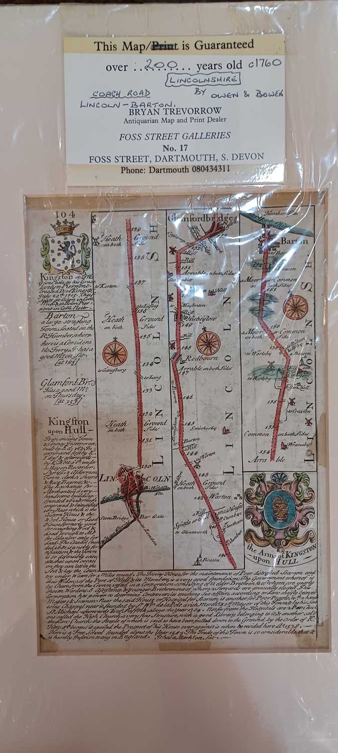
Bowen, Emmanuel and Owen, John, three 18th century strip maps; Northamptonshire - Lincolnshire, Lincolnshire, and Walton - Grimsby, each approx 19cm by 12cm, unframed

Valuation days

Related sold lots

Lot 685: Sold for £25 hammer

A 17th century edition of Camden's Britannia with English text, translated from ...

Lot 77: Sold for £190 hammer

A miniature almanack, Goldsmith. An Almanack for the Year of our Lord God, M.DCC...

Lot 204: Sold for £25 hammer

A Gerard Mercator map of Latium nunc Campagna di Roma 40cm by 50cm...

Lot 631: Sold for £40 hammer

Holland, Henry, Journal of a Voyage &c. to Iceland, in the summer of 1810, h...

Lot 119: Sold for £35 hammer

A framed John Speed map of "Dorsetshyre With the Shyre towne Dorcester described...

Lot 627: Sold for £100 hammer

An Emmanuel Bowen 18th century map of Sussex 'The Road from London to Arundel Su...

Lot 237: Sold for £160 hammer

A Arrowsmith, An Atlas of Modern Geography Constructed from the latest Observati...

Lot 210: Sold for £100 hammer

A framed 18th century Thomas Kitchin 'Accurate Map of Sussex Drawn from the Best...

View more sold Books & Maps